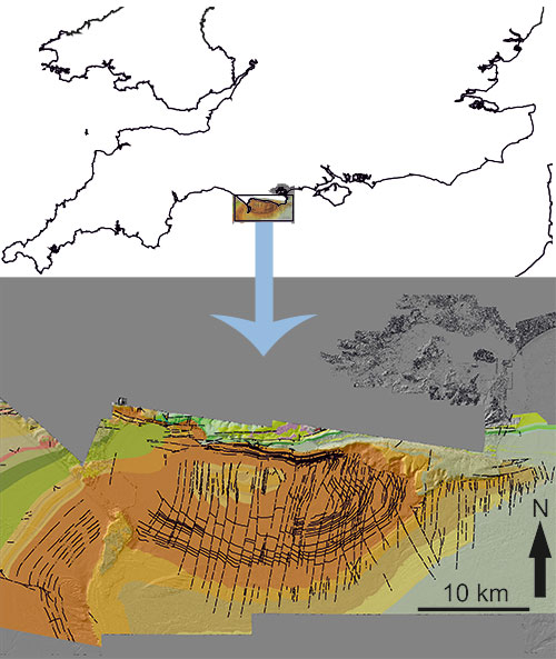
Scientists from the British Geological Survey (BGS) and University of Southampton have published a seamless onshore-offshore bedrock geology map of the eastern half of the Jurassic Coast World Heritage Site. This is the first time a map of this resolution has been published for the seabed in this area, and it will undoubtedly play an important role in effectively managing this sensitive coastline.

A screenshot of the new seamless bedrock map for the Dorset Coast as described in detail in Sanderson et al. (2017) and the map’s location in the UK.
The freely available online map is not only of research and public interest, but is also of value for coastal planners and engineers concerned with protecting coastlines. This kind of information will be vital to better understand and identify the most sensitive stretches of coastline including those that are prone to landslides or beach erosion.
The map was made with partners, including the University of Southampton (Ocean and Earth Science), under the Maritime Environmental Mapping Programme (MAREMAP). This wider programme of coastal research aims to integrate research from a variety of partners to inform practical applications such as marine planning, conservation and industry.
It was made possible through the use of the new generation of high-resolution, shallow water bathymetric mapping and aerial Lidar information. This has been collected, for example, as part of the Maritime & Coastguard Agency (MCA) UK Civil Hydrography Programme and the National Network of Regional Coastal Monitoring Programmes (coordinated by the Channel Coastal Observatory). This information then provides the backdrop for detailed geological surveying.
Professor Dave Sanderson, from the University of Southampton, commented: “This new approach to detailed, bedrock mapping clearly demonstrates that geology does not end at the coastline. Indeed, the extent of seabed exposure, along with the quality and resolution of the data has allowed us to fully re-interpret the geological history of this globally important site.”
Dr Travis Mason, Director of the Channel Coastal Observatory also commented: “This release of a seamless coastal map by the BGS, which uses data provided by the Channel Coastal Observatory, is hugely valuable for the coastal monitoring community, exposing as it does the key cross-over region between land and sea which is the unseen buffer zone for our coastline.”
The new research highlights how little is known about the narrow strip of coastline just below the low-water mark, despite its proximity to the shore. The ultimate aim is to address this lack of knowledge around the UK coast with up-to-date geological mapping, not just of the bedrock, but also coastal landslides and mobile sediments. To achieve this, areas such as the Jurassic Coast are being used as a test bed for new digital mapping techniques which can then be rolled out in the future to support UK and International coastal and continental shelf research.


