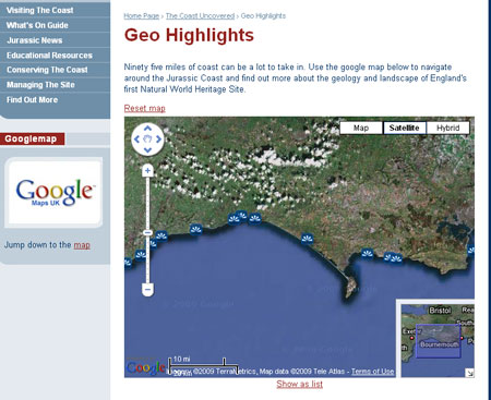
A new function that helps explain the geological highlights of the Jurassic Coast, both on-line and in-the-field, is now available at www.jurassiccoast.com.
By pin-pointing those locations along the coast that offer views which showcase the best of the geological and geomorphological features, you can begin to appreciate how the landscape was formed, and hopefully be inspired to visit the site.
The website itself has been streamlined to make accessing it from a hand-held device such as an iphone, that much quicker. But whether you chose to view these coastal locations from the comfort of your own home PC or from the South West Coast Path National Trail out in the fresh sea air, we hope you find that this interpretation will add to your experience.
Ninety five miles of coast can be a lot to take in, in one go. The Google Map function will help you to navigate along the Jurassic Coast and begin to get a sense of where the key places are that reveal how the geological story unfolds as you travel from west to east.
From Orcombe Point in the west to Old Harry Rocks in the east, the geology of 13 initial locations along the Jurassic Coast World Heritage Site have been interpreted in an easy to follow format covering age, key points, details of the geology and an insight into what the ancient environment would have been like.
Julia Pulman, Jurassic Coast Marketing & Communications Officer.


